

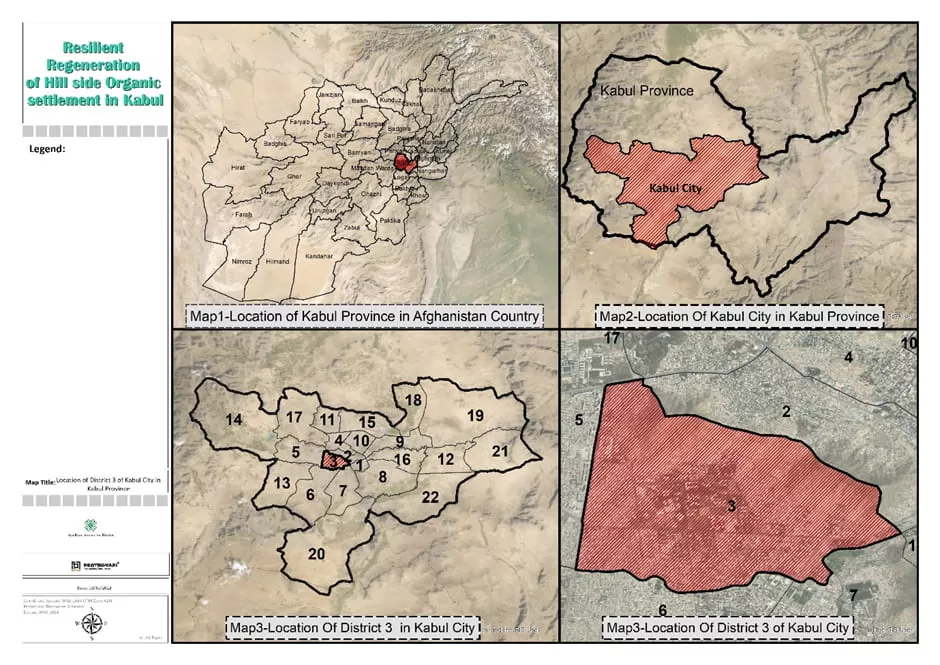
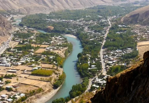
Location: Kabul, Afghanistan
Date of Start and Completion: August 2022 – December 2023
Clients: Aga Khan Agency for Habitat
Project Description:
In recent years, AKAH has developed several projects in Afghanistan, including Habitat Planning, Green Building Guidelines, and Climate Change Mitigation and Adaptation related programs and initiatives. These projects aimed to provide Afghans in urban and rural areas with sustainable, affordable, and resilient housing as well as a high-quality living environment. Given that Afghanistan is vulnerable to several natural disasters, including earthquakes, floods, and the impacts of climate change, the lessons learned from these experiences should be applied to more cities and villages.
Preparing a resilient master plan and zoning development plan are the most important tools for reducing risk, increasing resilience, and promoting sustainable development.
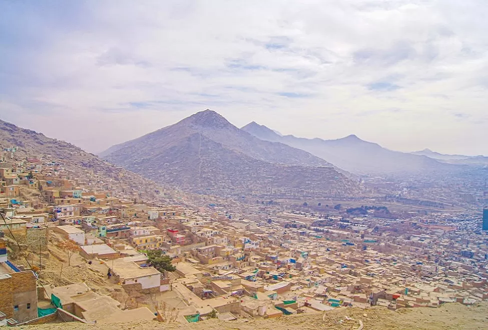
The informal settlements on a sloping terrain in Kabul’s District 3 are vulnerable to a variety of threats, but the capacity of the people is insufficient to adapt to the hazards. Both the physical and socioeconomic conditions in this area are insufficient to withstand the threats, leaving them relatively exposed. Due to the historic character of this district, resilience-based regeneration is a suitable strategy for its upgrade. This endeavor under the aegis of the habitat planning framework has the potential to serve as a model for similar districts in Kabul and other locations.
Provided Services:
The project was defined by the Aga Khan Agency for Habitat (AKAH) in the year 2022 and consisted of three primary deliverables. The main goal was to conduct a habitat assessment. The project was successfully completed by Protek-Yapi Company, utilizing the available data from OpenStreetMap (OSM), previous reports, Field surveys, and other relevant sources.
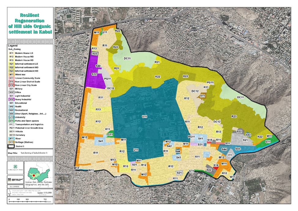
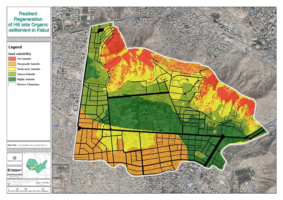
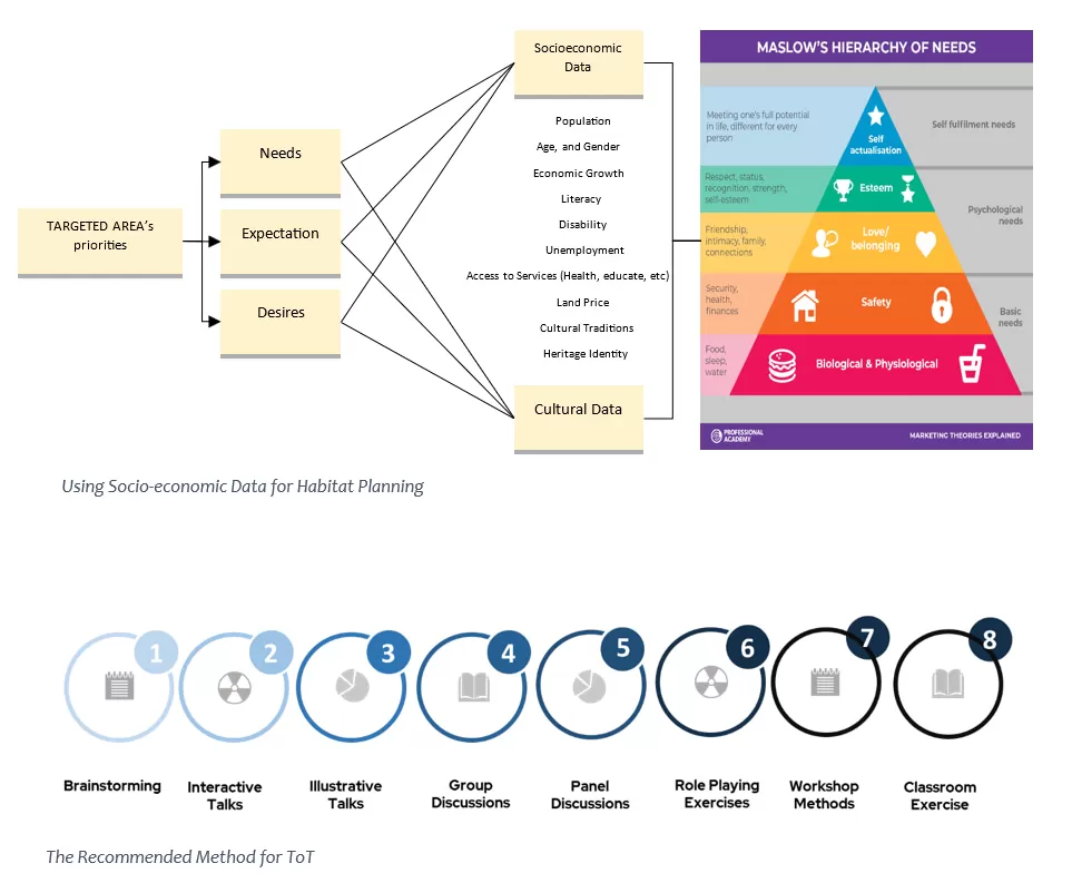
The main objective of the initial deliverable was to assess the socio-economic analysis of the area. This involved gathering historical and current data, as well as evaluating projected social and economic trends, needs, and opportunities. The evaluation encompassed a review of demographic changes, economic growth, and potential prospects. Additionally, it examined the community’s access to essential infrastructure and amenities, such as healthcare, water, sanitation, and education. The second major output of it involved conducting a physical and land use assessment. During this stage, an analysis of natural hazards such as earthquakes and floods was performed, resulting in the creation of hazard level maps. Additionally, various factors including historical analysis, road hierarchy analysis, and land use zoning analysis were examined.
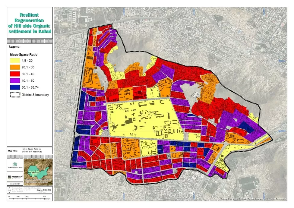
The ultimate outcome of this study was an exposure analysis and land suitability analysis, which provided insights into the vulnerability of buildings, critical facilities, and road networks to multiple hazards.


